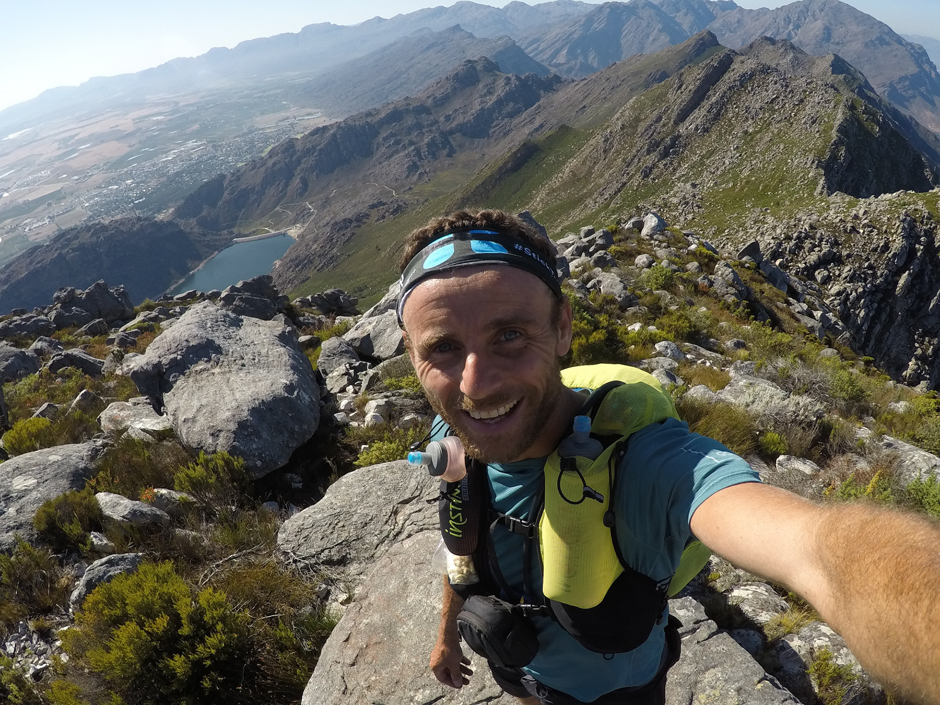
A chronicle of the first alpine running traverse of the Witzenberg Mountain Range. In February 2020 I ran roughly 70km off trail along a shark toothed ridge. I had to carry all my own supplies for a 36hr non-stop push which led me to the edge of disaster and back, in the most diverse biome in the world. Here's a multi media chronicle from some of the lesser explored Cape Fold and what it takes to navigate this ruthless terrain.
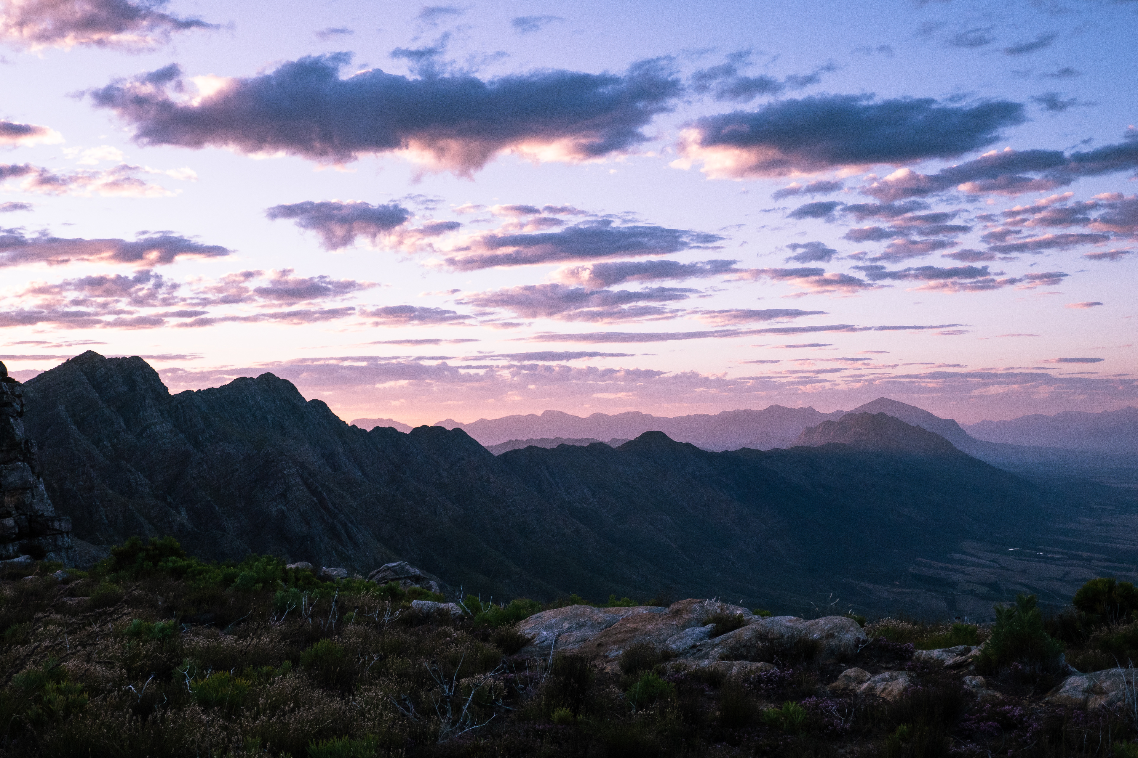
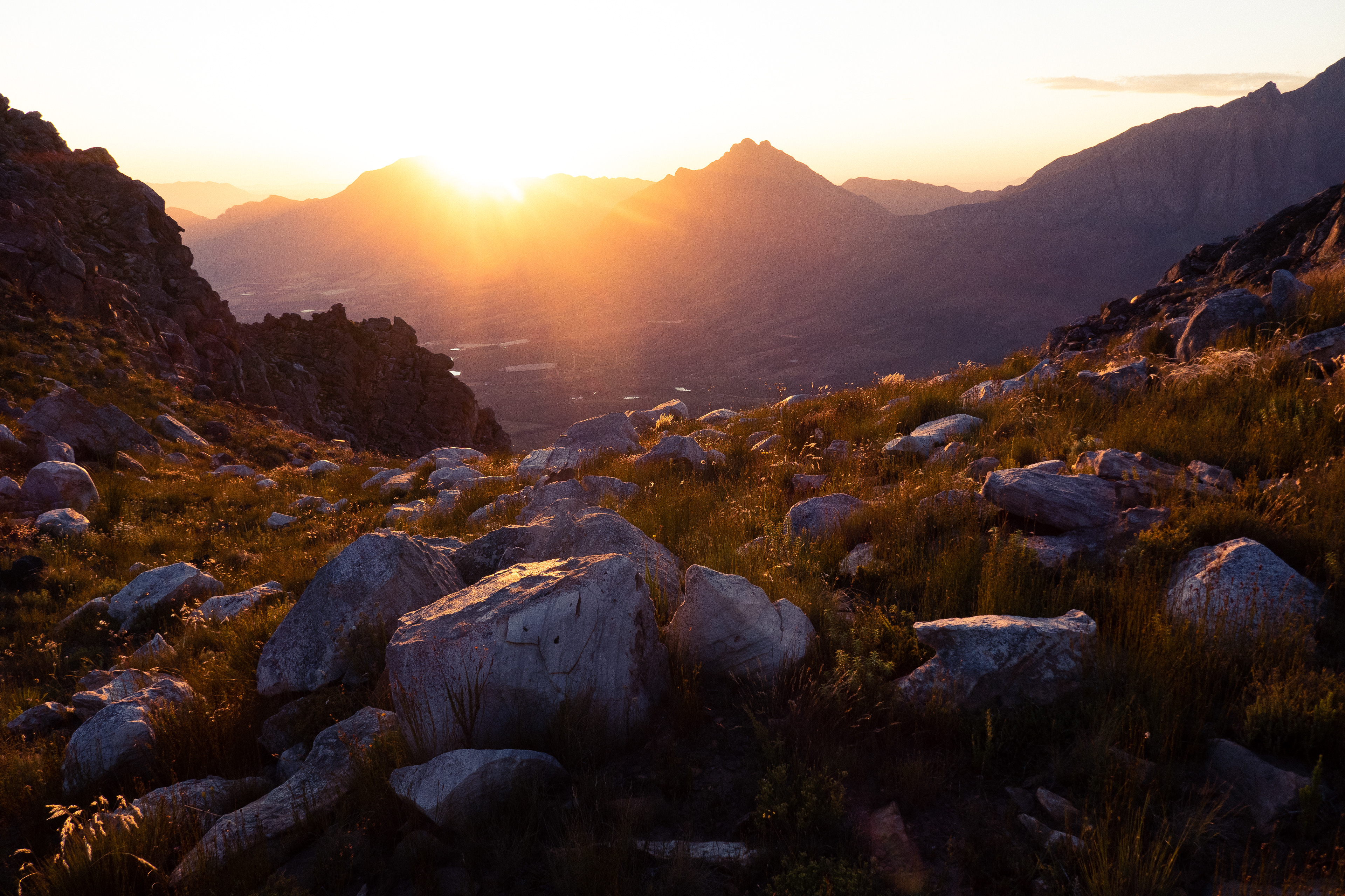
The Witzenberg at Sunrise
Intro
It’s an exciting time for alpine running in South Africa. Until now the places we explore have been largely restricted by the notion that in order to travel far we have to move slowly and carry lots of supplies. Moving ‘fast and light’ with a variety of mountaineering abilities opens the landscape to endless opportunity, particularly in the Cape Fold where the terrain is so harsh and previously considered inaccessible. It means we can move fluidly over technical terrain, we can climb up and down rock faces, and move between water sources fast enough not to dehydrate.
The sport is an intricate balance of need, knowledge and ability. Being honest with yourself, and humble to the landscape is paramount. The lighter the pack, the faster you can go. But skimp on something essential and you’re in big trouble. As things get more refined and every gram is counted, your strategy and predictions have to become ever more precise, as a minor mistake can escalate into a life threatening situation.
The reward of moving fast and light is the gift to use our bodies as they are meant to engage with landscape, stand in places very few people ever go - places untouched, undamaged - and truly understand our small existence on this wild planet. It takes incredible effort to traverse this land, and doing it self supported always leaves one humbled by the ferocity of the mountains. Why is something so beautiful, so hostile? Whatever the answer, it makes it feel like a great privilege to bare witness when one has had to work hard to achieve something. If it was easy, it probably wouldn’t be as grand.
For six months I’ve had maps pasted across my bedroom plotting a traverse of the Witzenberg Mountains. The following is an account of the adventure, some lessons learned, and a reality check of how a minor mistake almost ruined me.
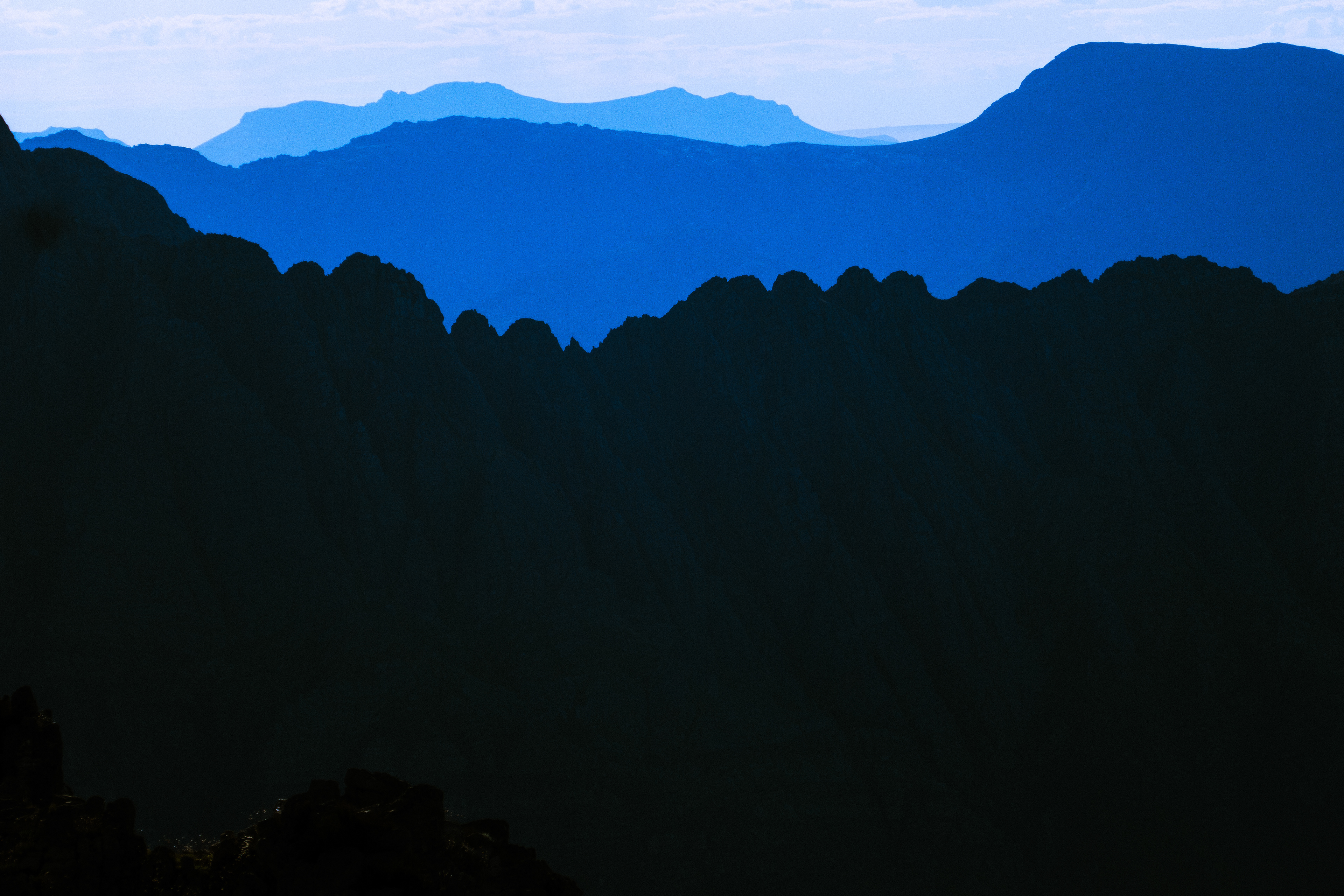
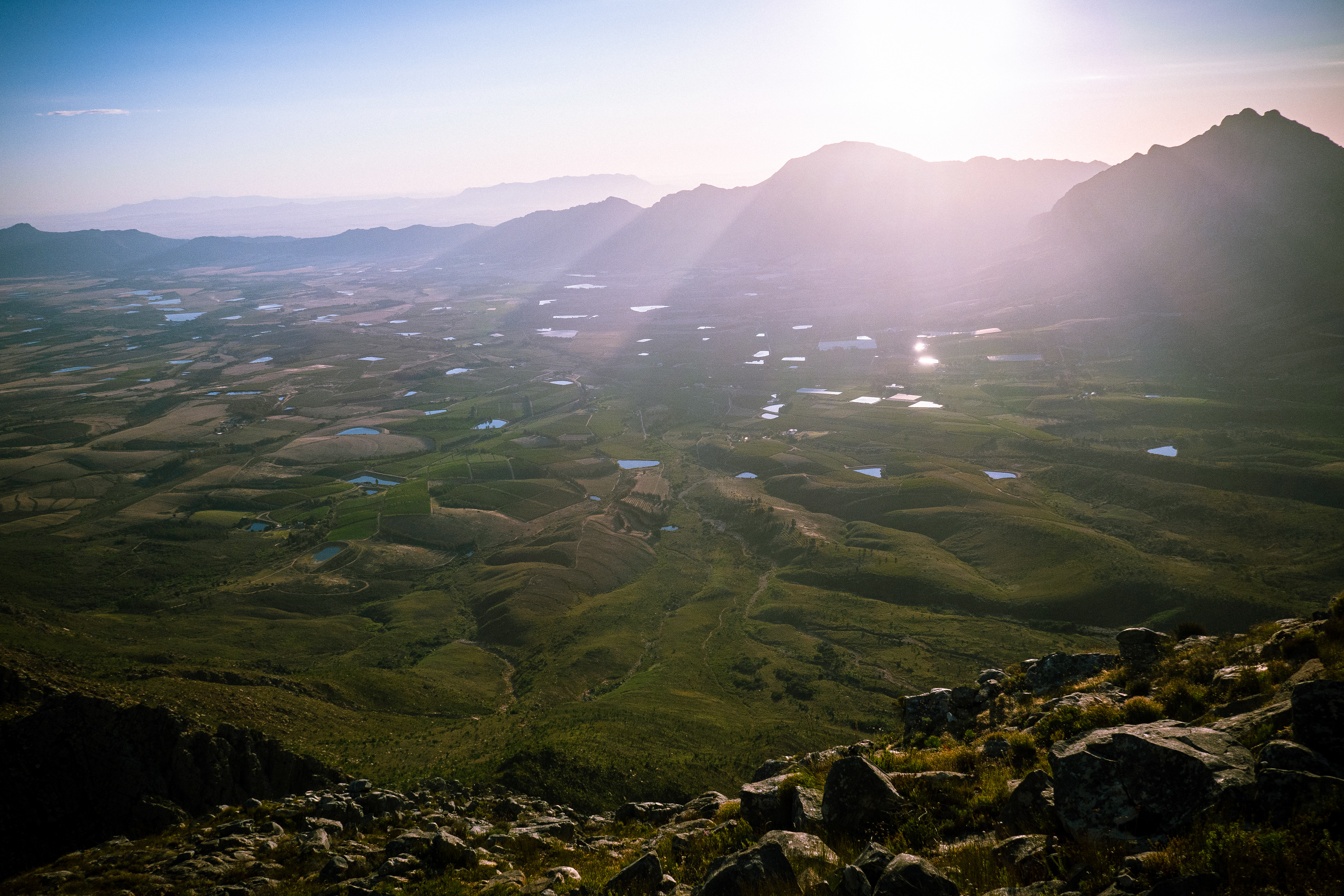
Above Ceres Dam

The Witzenberg / Winterhoek horseshoe. I started on the right hand side and progressed towards the bend.
The Objective
The mountains surrounding Tulbagh create a perfect horseshoe that begs to be explored. To my estimations it is a perfect 100km loop from Mitchells Pass to Bainskloof where one can see the entire route at any given moment of the journey. Where else is that possible? Some sections look rugged, others look fast, and through the Winterhoek range there are massive climbs. A perfect recipe for a great adventure. The goal is to traverse the entire ridgeline between these two points over a weekend.
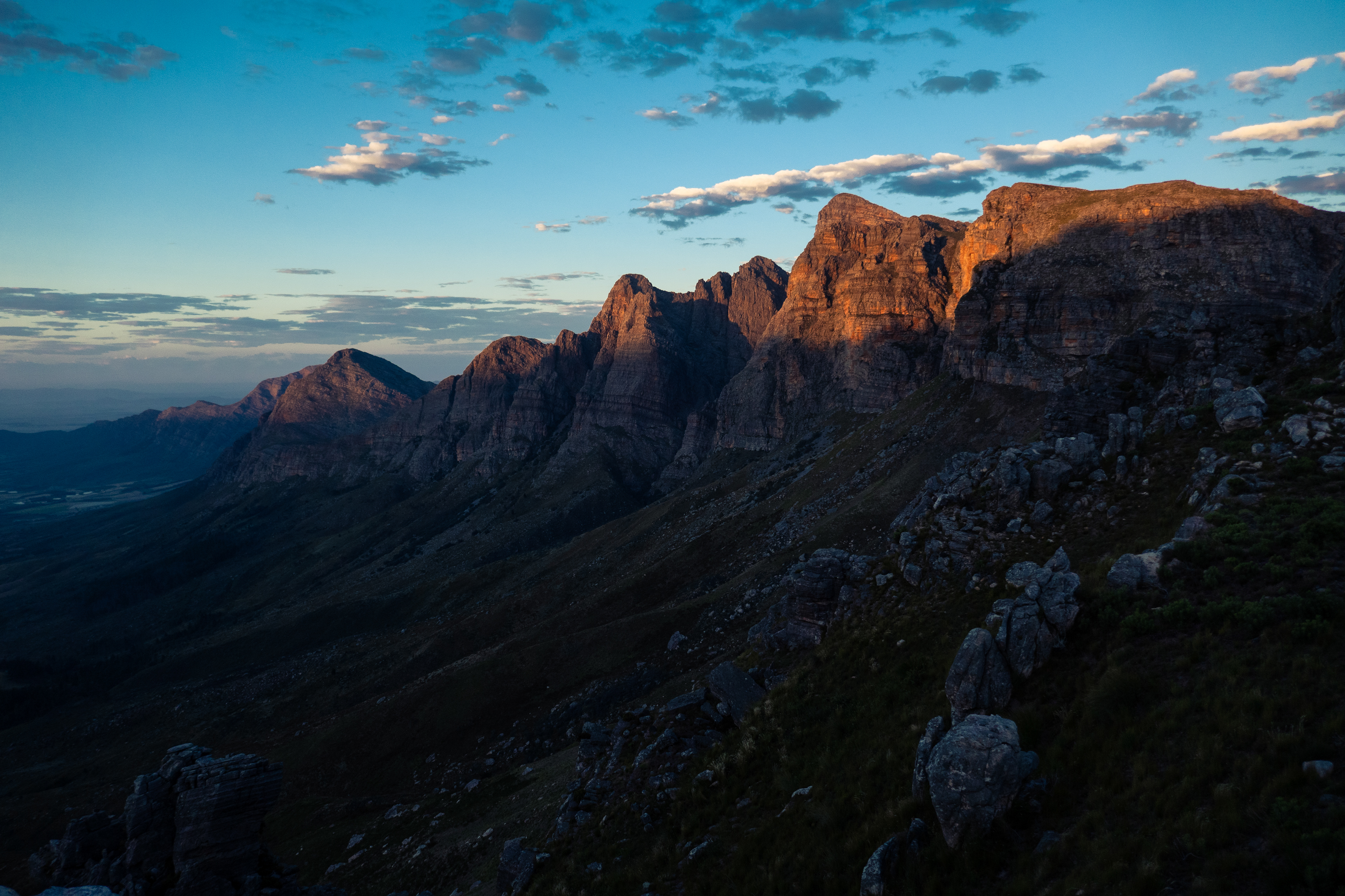
Witzenberg with the Hex in background
The Conditions and Terrain
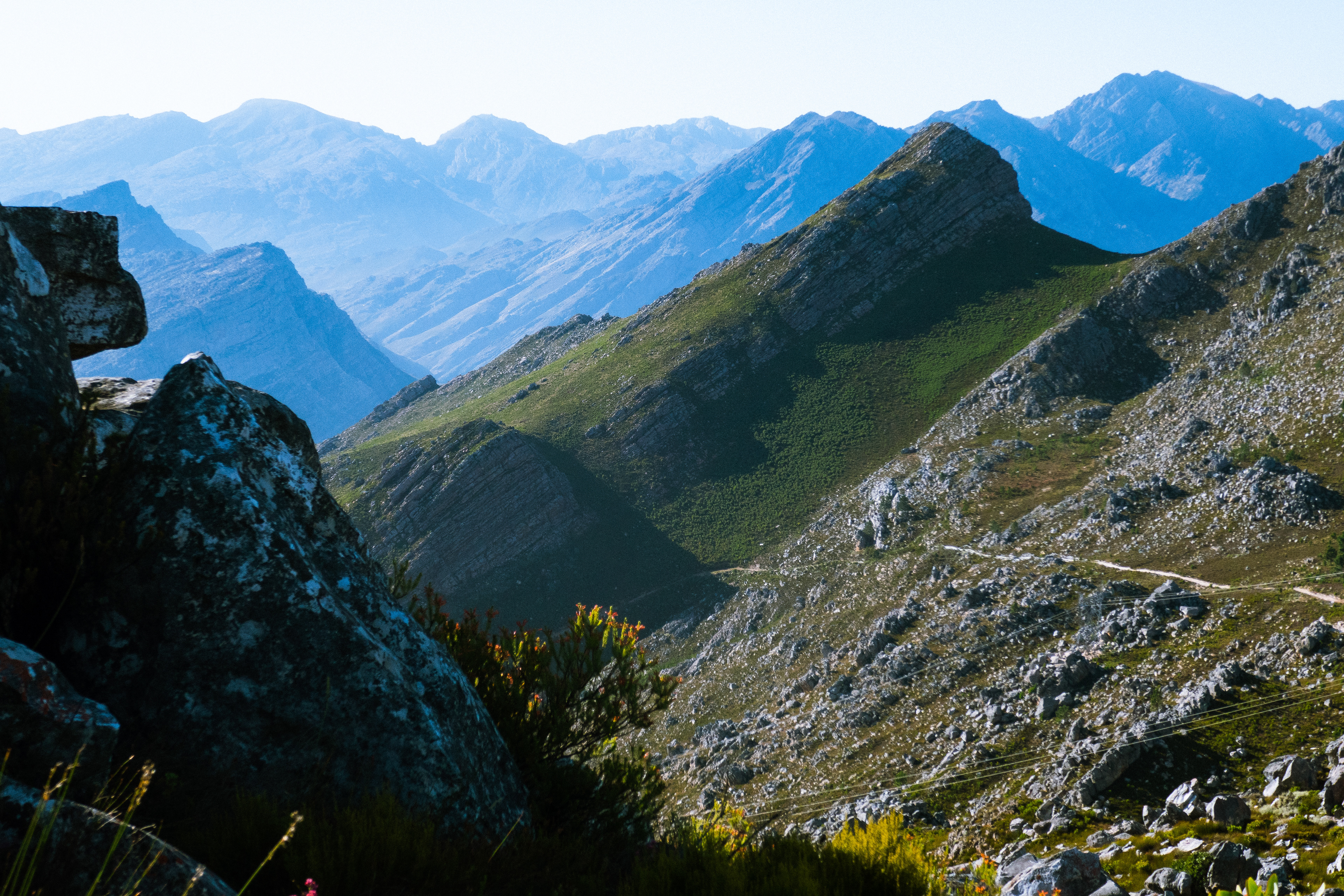
The Cape Fold far from the highest mountains in the world but they are rugged. It falls into the Cape Floral Kingdom which is the most diverse biome in the world, so for this story I’ll only refer to the northern section around the Witzenberg. It is characterised by sharp ridge lines where the only passage is on the very top. The walls are often too steep to navigate, and the vegetation can bring one to an absolute standstill and scratch you to pieces if you wander into the wrong area. Depending on which way the slope faces and how the wind channels, one can usually pre-empt the kind of vegetation ahead and if it is passable. Although my poor knowledge of biology has prevented me from working out a foolproof formula to this. This ridge is usually less vegetated with low-lying grass between scramble-able boulders. It’s often technical with steep rolling climbs, but it is faster and far more pleasurable than bushwhacking. So my usual strategy is to get onto the ridge and stay there as long as possible. The catch with the ridge is that there is seldom water found up top. So the quantity of water you can carry will often decide how far you can go. And on the Witzenberg, there is minimal water. None is actually a more accurate figure for the water up top. The first semi-confirmed water I had heard of was at Sneeugat, about 50km into the run and a bit off track. It was clear that water was going to be one of the primary concerns for the trip. From a distance the ridge also presented an ongoing serration of teeth cutting into the air - not big enough to show up on a map, but big and regular enough to make you sweat to cover a short distance. It didn’t seem like I would be covering ground fast on first assessment.
Based on my map reading, the crux seemed to be at the turning of the horseshoe where the Witzenberg meets the Winterhoek. Here is a section of contour lines that are so tightly compressed that I couldn’t actually work out a practical way through, or if it was possible at all. If I could get through this I was pretty sure I would be ok. The biggest climbs were in the Winterhoek, but the terrain seemed far easier. It was just a game of endurance from there on. In theory.
Gear
I wanted to refine my pack as much as possible to maximise on efficiency. Weather was looking good, but forecasts are almost never correct on top of mountains, so I was considerate of essentials that would keep me alive, but carried nothing for comfort. I was planning to be on my feet for 36hrs, so stocked sufficient food for this timeframe, and since water was a concern, brought as much as I could carry. Everything fitted into a 12L pack and included:
1x 2L bladder
2x 600ml soft flask
1x 500ml soft flask (3.7L of water in total / 3.7kg)
8x DripDrop ORS Rehydration sachets
1x 500g gnocchi with sun-dried tomato pesto (ate 400g)
1x 250g cashew nuts (ate 150g)
1x 250g biltong (ate 100g)
1x 250g dates (ate 200g)
10x Energy bars (finished)
6x Gels (finished)
2x Bananas (finished)
3x Cheese n ham rolls (finished) (about 2,25kg)
1x Rain jacket
1x Windbreaker
1x Down jacket
1x Mid layer
2x Base layers
1x Long johns
1x Buff
1x Gloves (probably 1.5kg)
1x Compact camera
1x GoPro
1x Bivvy bag
2x Low-amp power banks.
1x Torch
1x Cell phone
6x Painkillers
(total weight probably 8kg)
Considerations:
* I opted not to take paper maps as a backup (had maps on phone). It also, in theory, shouldn’t be hard to navigate
* I opted to use Google live location instead of a Spot Tracker (it worked more efficiently on a previous run)
* My phone mostly on airplane mode, would have enough battery life to make 36hrs, but I brought a mini power bank just in case I needed a charge. The 2200mA I have usually gives me one full phone charge.
* I brought one other lower powerbank for my watch. It was an option to bring a heavier 10 000mA power bank which then could also charge my torch, cameras, phone and watch, but I deemed this unnecessary as there should be sufficient battery in each item.
* Instead of packing a sleeping bag, if I slept I would put on all my clothes, and if it was very cold or raining I would get in the bivvy bag (which is a glorified space blanket) It would be uncomfortable, but I would survive.
* All food was ready made so I didn’t have to carry a cooker or utensils.
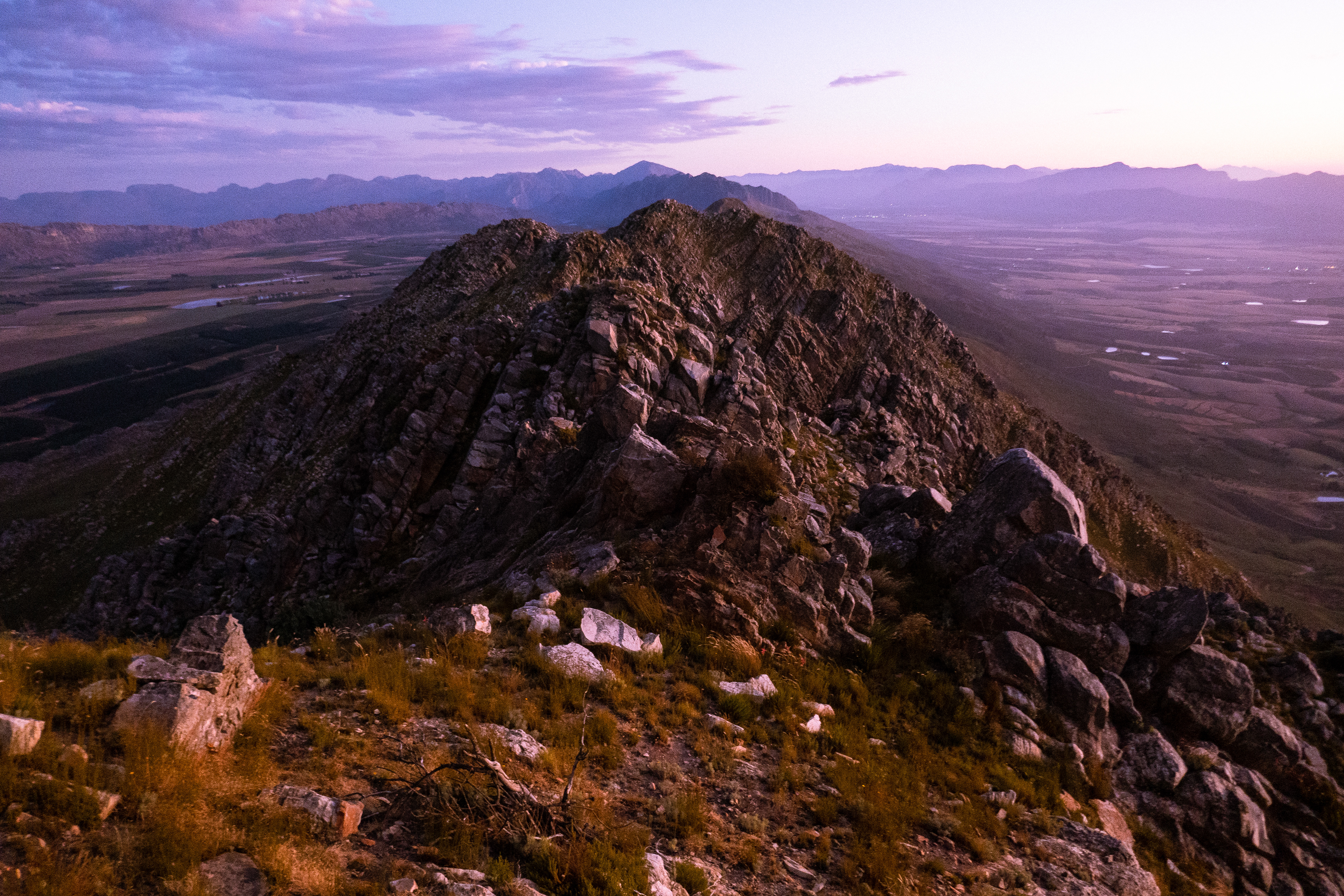
Looking across to Kleinpoort se Nek - my escape route
How it runs
14 Feb: Prep. Buy everything, pack everything, charge batteries, go over concept with Genia (my emergency contact and pick up)
Saturday. A beautiful line.
15 Feb, 4am: Wake up Call
4:30: Departure from Cape Town
5:00: I realise I have forgotten my watch at home. For the first time I had not slept with it on and was charging it out of general sight. Rookie error No.1. Little did I know how this would affect the trip.
6:00: Leave a water drop on the only road I cross, roughly 80km into the route.
6:20: The run starts
The beginning of these runs always fill me with anxiety. I’m leaving my car on the side of the road for days, there’s the risk of landowners getting angry with you being around, and I find it takes some time to settle into a flow. This becomes easier once I’m above civilisation and practicing my trade effectively. Since I didn’t have my watch with me I started recording the run on Strava via my phone. Rookie error 2. Rookie error 3 was that Genia had an issue accessing my Google live tracking.So I didn’t have any tracking, other than WhatsApp messages I would send from the summit of major peaks or before technical sections stating my location and current state of affairs. But this would only come into play later.
The route starts off with a 10km climb to get onto the ridge 1100m up from the start. It is a solid slog, but luckily I found an overgrown service road that meant there was a vague path cut through the protea bush. Otherwise I might have aborted before the show had even started!
8:20: The ridge was magnificent, with rolling climbs on predictable terrain. It was too technical to run, but it was easy to keep a fluid scramble pace. The trick here is not to stop. Every faff accumulates and can quickly turn into hours of lost time. Technical descents keep heart rate low, so it's easy to move at a sustainable pace and make steady progress.
Nerves were shaken when a rinkhals was spooked and ran up a rock face next to me. I shat myself and flew in the other direction (as usual). Not 5mins later two bucks waited until I was right on top of them and then bolted out of the bushes, leaving the second skid in my shorts. In general the wildlife was vast all across the ridge, with the exception of near a logging plantation. Eagle, chameleon, spider, and a huge variety of small birds occupied the land. More than I’ve ever seen before. There was also the odd leopard print.
In general things went well and I made good progress at about 3km/hr, which for this terrain is considered decent. But the heat was escalating fast.
14:00: I finished all of the water I had brought with me. It was concerning how quickly I had finished it, and I had no idea how I would fare until I got to Sneeugat where there was rumoured to be water. Ignorance of what lay ahead probably worked in my favour.
15:00: Fortunately an hour later I descended a saddle that arched very close to ground level and perfectly nested here was a dam. It was an absolute lifesaver. I downed 1.2L on the spot, wet my body to cool the thermostat, and very quickly felt like a new person. Not only that, there was a jeep track leading away from the dam for as far as I could see into the horizon. It was the calm before the storm.
The late afternoon temperature surged and I noticed my water declining much faster than the first load. As I started climbing back onto the ridgeline through thick vegetation and on a steep slope, I started to feel the first signs of heat exhaustion and being on my feet for 12hrs. But energy levels were still high. Approaching the Bellevue Peaks was hard going and the scrambles became sharper and steeper. It became clear that I was not going to make it to Klein Winterhoek before dark. And as night fell, things started to get crazy.
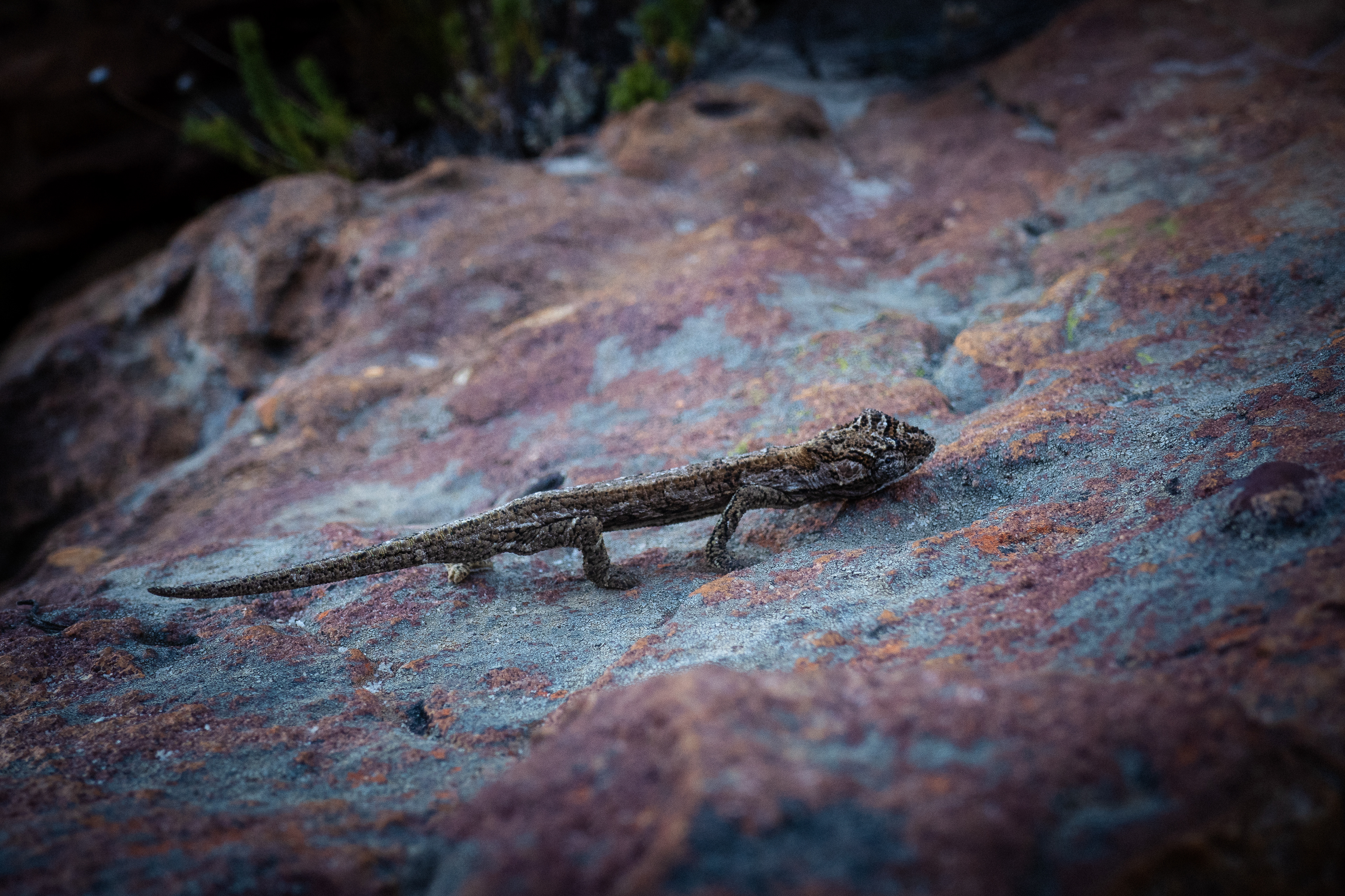
Chameleon
Night Fall. The demons come out.
19:30: The list of concerns were rising. I was chronically low on water and rationing sips at an unsustainable limit. My phone battery was also running flat. Having Strava operating in the background had consumed more charge than anticipated. And now as night fell on the most technical section, reading maps was critical for the first time. I now had to restrict screen time as much as possible to make it through the night. I was keeping it on airplane mode, but for some reason when I turned on my data it would not send messages, meaning I had to restart the phone, using more battery, and this was critical to relay my location to Genia in case something went wrong. And in the back of my mind, I knew there was a chance of something going wrong.
These situations don’t evoke panic or fear in me though, they heighten concentration and focus. This space is where true self reliance and responsibility comes to the forefront, and it is when I feel most alive. Decisions have to be made fast, and there are no second chances. Risks are calculated and exercised regularly, and at some point become standard practice. The definition of risk shifts and confidence in your ability rises. Every sensation is heightened and one feels absolutely connected to the surroundings, walking a tightrope where you are safe, but step a millimetre out of place and you’re in mega trouble. I went into mission mode.
The only things I had going for me were the good weather - a perfectly clear, warm evening with minimal wind - and the fact that I still had energy. Everything else was a race against the clock. With time, dehydration would get worse, batteries would die, and the chance of weather changing increased. So my game plan was to traverse as far as possible before daylight, when emergency procedures would become easier to execute if necessary.
I plugged my phone into the 1st powerbank to charge. With a finicky cable it only seemed to load up to 30% battery life before the powerbank depleted. I cursed aloud at this point. I was now on Bellevue South and the gradient of the walls were some of the steepest I’d come across. Moving over the upper koppies, night fell, and torchlight began to guide my way.
Terrain leading to Bellevue Peaks
21:20: I was totally out of water and had barely drunk for hours. My mouth was completely dry of saliva. I wasn’t producing any and this was making it impossible to eat. Food would turn to plasticine in my mouth and was impossible to swallow. A single bite of an energy bar (the juiciest food I had) would take up to five minutes of swishing around before I could stomach it. My lips were developing a slimy film that would clump into balls reminiscent of snot, and my tongue would stick to my palette to a degree that made it hard to talk. In total I had drunk 8.6L of water that day, but had pee’d out just about nothing. This weird response in my mouth concerned me as I have suffered dehydration before and know how paralysing it is. Sheer exhaustion kicks in almost instantly, dizzy spells restrict movement, all one wants to do is sleep. And right now that was the worst thing I could do. Bizarrely though with these symptoms, I still had energy. I can only place this down to the DripDrop Oral Rehydration System I had been consuming throughout the day, which works more effectively than an IV drip. Water levels were running dry, but sufficient salts and electrolytes were in place to still keep my body operating. If it wasn’t for this I would be fodder for the vultures.
22:45: In a time of urgency things one would never consider doing become quite sensical. So it was, that I suddenly felt an urge to pee, and realised this was the most water within kilometres of me. It didn’t take much thought at all, I simply pulled out a flask and urinated into it. I didn’t even manage to excrete 100ml. There was clearly nothing in my system. I sat down, reflected on every alpine expedition I had read about where drastic measures had lead to this, and it seemed part and parcel. I swigged the biggest gulp I could, swished it twice around my mouth and swallowed as quickly as I could. A sudden pang of ammonia rose out my throat causing me to cough. And then it was done. I ate some nuts, chewed as much as I could handle, and then glugged another mouthful to help with digestion. It was getting easier. The engine kept running.
Fatiguing in the early hours of the morning
16 Feb, 1:00: Navigating at night is a surreal experience. Your perspective travels as far as your torch light, and without bearings it is easy to go off route without knowing. There is no sense of how far you have progressed or what is to come. It is just a matter of dealing with the immediate challenge. A ridge provides some security in the sense that there is generally a singular direction one can travel, but that doesn’t mean it is an obvious line. The climbs ahead of me were getting steeper, some resembling the Flatirons - smooth rock surfaces at an angle barely positive enough to gain traction on - others were more short face climbs requiring a bit of climbing to gain the next level. Once at the summit I had to descent something just as steep and long, only to be met by a 5m saddle of scree and start all over again. I explored around for other options as I couldn’t believe this was the route, but there was nothing. On either side of me the ground fell away to a distance far enough not to allow my 900 lumen torchlight to reach the ground, and at an angle that made me feel like I was walking along a bridge. For this section the map depicted spaced out contours and an obvious line across the top. It looked so gentle, but all of these ridges must have been just under 20m, hence not being noted on the map. It was hard to believe I was on the right track, or that a map can be so deceptive, and I grew anxious that I was off route and potentially going to end up stuck on a cliff face. But there was no where else to go. So I continued following the ever steepening climbs through the path of least resistance. At the worst I was up and down climbing roughly (sport) grade 15/16s… in running shoes… in the dark… and having been on my feet for 21hours.
1:40: The sky was magnificent. It was a perfectly clear night and the milky way was thick with glittering stars. The only noise came from the occasional gust of wind, breaking the ring in ones ears that comes with pure silence. That ringing, coupled with the blackness all around me gave a sense of anti-gravity, as if I was floating above the world. The light flicker of farmsteads far below were another galaxy away. I lay on my back and looked up at the southern cross, and realised that all the stars were shaking in different directions. They weren’t satellites, it was my vision. I was bonking out. And in this moment of calm I decided it would be best to rest and pick the game up with a more alert mind. In a saddle I found a 0.5x1.5m patch of semi flat ground, threw on my down jacket and lavished in the sensation of stillness. I set an alarm for 3am, and plugged my phone in to charge. But only my watch’s power bank was left and the ampule was too low to keep the phone charging, so it switched off after 30secs. I was too tired to be frustrated by this and I slept.
It first felt like miggies. But swatting didn’t get them away, and covering up didn’t stop them from getting deep under my clothes. Eventually I turned on my torch and I was covered in ants that had smelt out my pillow of food. I swatted them and left for new ground, only to be hunted down again. It was hopeless. My 80min sleep dwindled down to 30mins. But it was enough to perk me up. It was time to make drastic decisions.
Terrain traversed in the early hours of the morning
3:00: A half moon had risen and cast a silhouette of a massif in front of me. I couldn’t tell distance, but it seemed relatively close. There was however an incredibly large gorge between myself and the massif. Based on the map this meant I was on the Swartgatpiek, and the massif was Sneeugatpiek - the end of the ridge and the beginning of the turn to Klein Winterhoek. Again, the ‘obvious’ line on the map was inconceivably rigorous, and this time my instinct dictated not to attempt it. So I opted for the better of the bad options. After careful analysis of the map, which I knew too well was not a true depiction of the land, I started descending a gorge with grassy embankments that I could hold onto for support. The map predicted that this turned into an amphitheatre further down, but the angle was already too steep for my torch to pick up where the drop-off might commence. Shortly before this wall, if I swung right, I could traverse to a gentler angled face which led up to the Sneeugat basin. Every step brought the uncertainty of slipping and sliding off the mountain. What looked like miniature plateaus to rest on turned out to be ribs of rock, steep walls just sitting under the contour level again. So what was expected to be flat became more climbing, and then more steep descending on the other side.
4:45: The vegetation grew thicker and suddenly a pang of excitement sent a cold shiver straight through my body. That sound will forever be ingrained in me. The trickle of water. Nothing else was important anymore. I ran to the sound and pulled out bush until I found a light spring surfacing from the rock. It was just sufficient to fill a bottle. Emotions spun that joy of meeting a loved one after prolonged absence, of stepping away from a Russian roulette table and then realising what that meant, and that instant relief of pulling out a thorn. I wasn’t far off crying. It had been nine hours since I had last had water. I downed a litre on the spot and soaked my head as if abundance was eternal. My stomach churned a bit with the sudden influx and I realised I had to eat in order to keep going. So I pulled out my gnocchi dinner which had been impossible to eat earlier due to my saliva-less state, and ploughed spoon after spoon into my face. Each mouthful required a squirt of water to digest and it went down like a treat. A few nuts and biltong were had for dessert and then I was confident that I had sufficiently refuelled to make another long haul into no-mans land. Instantly I felt like I was back on my A game, and to crown things off, a sliver of navy blue was forming on the eastern ridge line, now three hundred metres above me. I was at the end of the tunnel.
Klein Winterhoek
Sunday. A new chapter.
6:00: The progressive introduction of light eased navigation and my surroundings started becoming evident. A grass embankment revealed itself and I pulled my way up to the Sneeugat basin. The purple predawn hues splashed the surrounding mountains and my legs remembered what it was like to stride as I crossed the lip of the basin. Crisp air icing my perspiration. Waking birdsong levitating above the rested land. The delirium of no sleep sprinkling sugar over what was already breathtaking. These are the moments I run for.
A trade off happens at this point where the technical terrain is left behind and replaced with huge steep climbs. Grasslands take one up a 300m wall to reach Horseshoe Ridge, from which a traverse circumvents to Klein Winterhoek Peak while elevating another 300m. After this a steep descent towards Kleinpoort Se Nek is tackled before the 800m summit of Kleinpoortpiek and then immediately afterwards the 1000m summit of Roodezandsberg. If I could get over that it would be easy sailing to Bainskloof. It was much later than preferred but I was confident that I’d move faster through this section.
10:00: I passed Klein Winterhoek and the Cathedral Spires with ease. The descent of the Spires once again reminded me of the Flatirons as I pulled on the brakes to stop myself sliding down this remarkably smooth and steep plate of rock.
The descent to the saddle starts out easy enough with a selection of lines posing as possible ways down. I trundled down as close to the Nek as possible without crossing the Spires. The Spires looks like a good line but I wanted to minimise climbing at this point, and there was a lot of gnarly climbing involved on that route. So I came down the next embankment until it curve rolled into a wall. There was no way down. So I hiked back up and tried the next ridge. At this point I was charging my phone with my watch’s powerbank, which took about 5mins of turning it on every 30secs to get a 2% charge. So everything done on phone was done with urgency, and unfortunately too rushed to be comprehensive. Therefore map reading was complicated. The next ridge ended in a wall as well. So I traversed into a gulley where I encountered thorn bush but I pushed through unfazed believing I was getting closer to an open line. It turned into a stream, and then a waterfall. I had to hike back up through the bush and traverse further around. At this point the entire landscape was dense in thorn bush, burned protea and shards of stick that poked through my shoes. Over the next three hours I traversed and dropped in minuscule increments until I realised there was no way I was going to make it to Bainskloof. The terrain was impenetrable. What broke my morale was the resistance against my effort. Every step was clumsy on the steep slope, sunburned legs permanently being scratched raw, high energy effort that only took me a matter of meters, and then having to retract them and try again. It was a horrible practice of pain and patience that I could not justify.
12:30: Still not even half way down the slope I decided it was wise to abort, and told Genia I was going to try find a trail leading towards Tulbagh.
14:30: I reached the base of the valley, and started hiking up the valley towards Kleinpoort Se Nek where I could down climb the wall into farmlands and escape to a road. I was now kilometres off route and continued to battled thorn bush all the way to the nek.
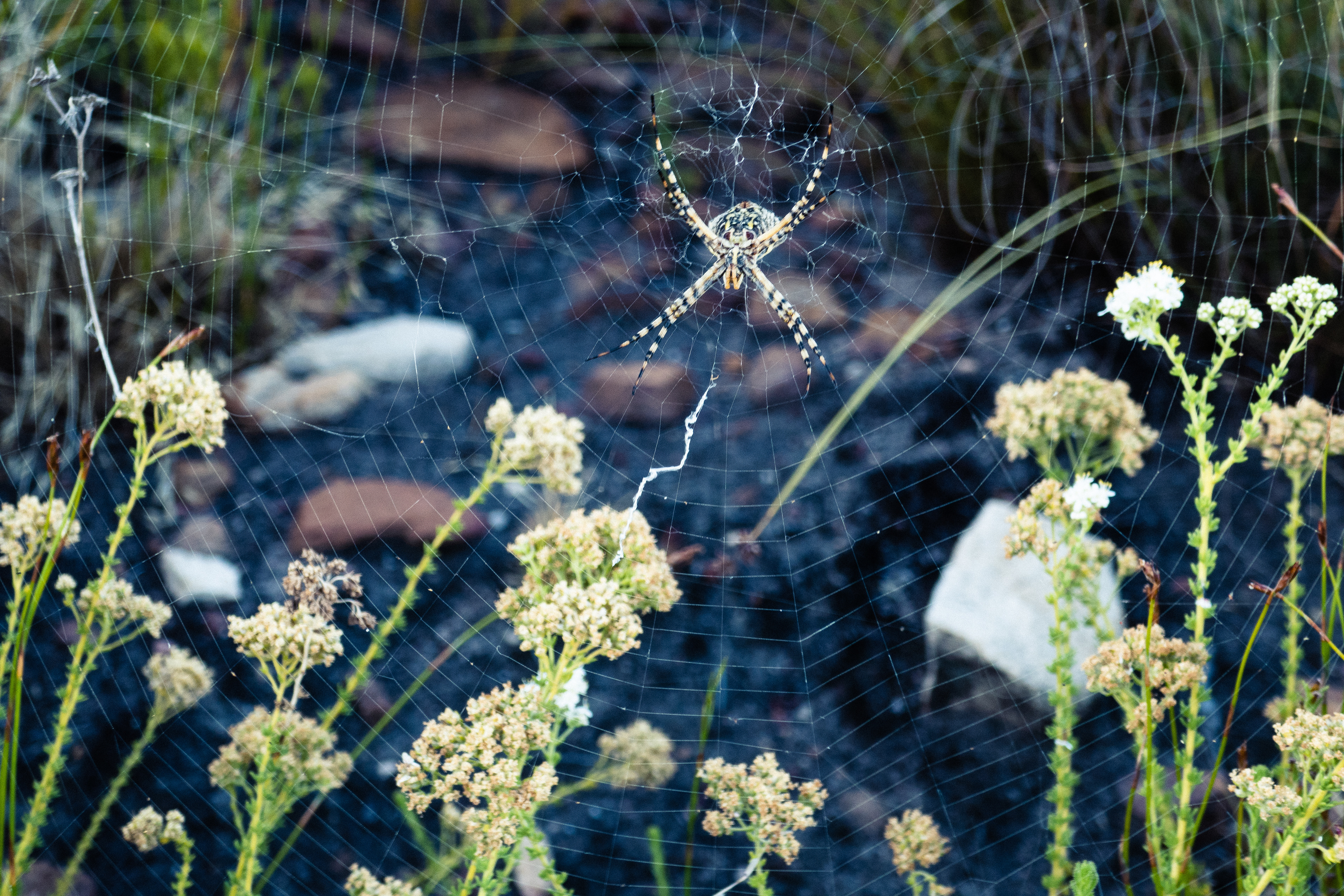
Golden Orb Spider
17:00: I don’t have any documentation of this section of the journey. The relentless struggle drove me into a tunnel where I had to shut down all senses in order to keep progressing. I couldn’t think about anything as consideration of anything would advocate how hopeless and miserable this situation was. I was totally uninspired, didn’t even consider taking out a camera, and maybe that’s a good thing as all that would have been recorded was bitching. I’d choose life or death situations over this violently passive push against the tide any day. At least that takes thought, evokes some excitement or fear (whichever you choose) and leaves one with some sense of accomplishment. This was just miserable. I had spent the last seven hours being torn to pieces while getting nowhere. But finally I was on a jeep track. I sat to charge my phone to 2% again and rapidly wrote to Genia to meet me on the road. I dropped a pin on a junction and said I would be there in 15minutes. It brought relief but I was still humourless.
17:30: Out of the bush I found that I still had some vuma in the legs. A welcomed reality check considering my accumulated sleep amounted to only 40mins over the last 36hrs. The endorphins returned. Once on the road it all felt too easy and I plodded towards the junction. I was far from completing the original challenge but I had seen all of the range that really excited me. It had also been an enthralling adventure and now so close to home the magnitude of what transpired hit me. I rode that happy feeling that comes from walking away from death. It’s gratitude on steroids. That makes the mundane necessities of life seem so valuable. Well… at least for a while.
Genia wasn’t at the junction so I charged my phone for the last time before it died. I told her to drive down the road and she’ll see me. What I didn’t know was that in my race against my phone battery dying I had pinned the wrong junction. And now had told her to drive further off route. My phone went black and our comms died.
19:30: I walked into a labourers cottage where a man lay passed out against a steering wheel of a car and two girls watched a cricket match inside a well-kept living room. They let me plug in my phone to make a call while they tried to piece together my situation. I tried to piece together theirs as the man woke up and drove the car into a bush. We all have different notions of normality I suppose, in our own way living out what someone else will consider crazy. Genia arrived, and I stepped back into my daily grind.
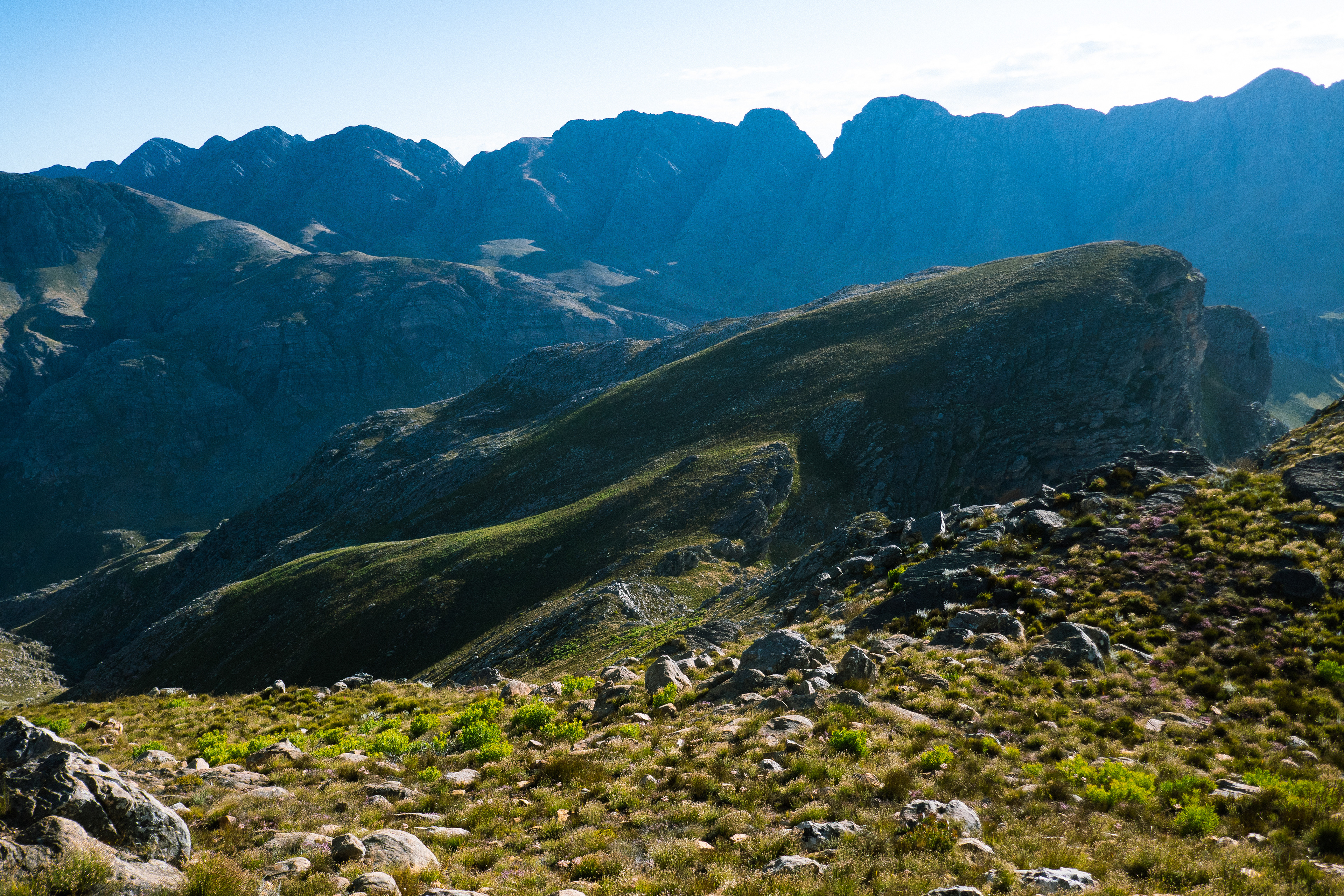
Koppie on Horseshoe Ridge
Tulbagh valley
Technical thoughts on reflection
* I must be more organised during preparation and pre-empt my state of being before I begin. A simple thing like forgetting my watch played a catastrophic role in hampering this trip where such a precise measure of resources was executed.
* Even though it is heavier, it would have been worth having the 10 000mA powerbank instead of the two smaller 2200mA ones. That said, if my plan was executed flawlessly I would not have required the additional power.
* GPS - In places with reception Google live location has proven to be more accurate than Spot Trackers. It’s also lighter. But there is a heightened risk if all your tech is phone dependent. If phone dies, everything dies. Independent devices are safer. In this case if something went wrong, the live location and my text updates on location would have been sufficient to find me. But without reception this option is useless. I also assumed Genia would be able to upload live location. I should have checked this beforehand.
* DripDrop ORS Rehydration saved my bacon. Considering my state of dehydration I cannot believe I functioned the way I did. I can only place that down to the DripDrop ORS I consumed on the Saturday. In previous experiences dehydration has almost paralysed me with exhaustion. Even though I was so parched I never lost my ability to move, which potentially saved my life.
* I’d decrease food by 400g.
* Although I didn’t use my warm gear it’ll still remain in my essentials pack.
* Not having a sleeping bag was a great call. That weight would not have been worth the use I would have gotten out of it.
* Likewise with not having a cooker. I think this is only viable for trips 3 days or longer where dehydrated food can save significant weight.
* It turned out I had a strained hip flexor on the trip. Although not the healthiest, a painkiller on route made a huge difference in keeping me mobile.
* I should have brought a cap. Got lank sunburned.
* Paper maps wouldn’t have helped me in this case as there were no leads to bean count with. There were only peaks, and there were so many hidden peaks that I would never have kept an accurate count. Especially in the dark. Another interesting point on finishing was that I realised I was so zoomed in to the map on my phone that I potentially was mis-reading the gradient of the slopes. At a 1:50 000 size, what I was covering was way steeper than what I was interpreting on the map during the time.
* I got very lucky with water and weather. Though the heat certainly contributed to dehydrating me.
* Long johns saved my life in the thorn bushes
* All my gear held up well. I think I'm final getting close to having the perfect set up.
Many thanks to DripDrop ORS and Flat Rock Endurance for supporting my unconventional endeavours.
Over 'n out